
Historic Quaker Houses of Chester County, PA
The Hance House
Built in 1795 and Enlarged ca. 1850:
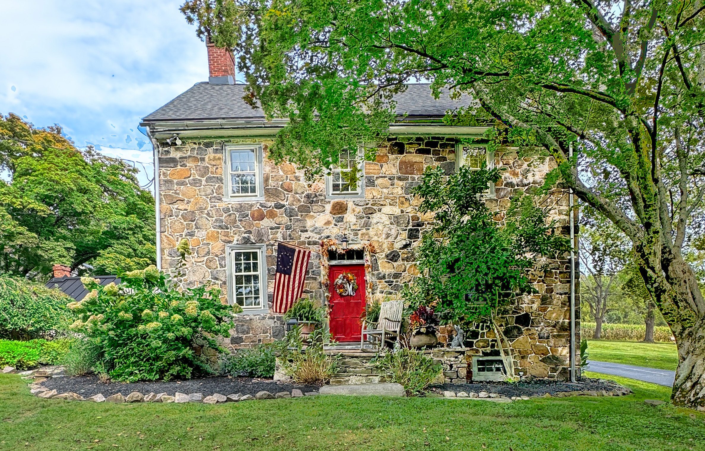
The Hance House stands on a tract originally settled by English immigrant Richard Buffington in the late 17th century. Joseph Hance, a grandson of Buffington, built this house ca. 1795.
The farmstead remained within this prominent, largely Quaker family for generations. Many members of this family attended the nearby Bradford Meeting in Marshallton. The surrounding area along the East Branch of the Brandywine River was known as Buffington’s Ford until 1862, when the construction of a covered bridge prompted a name change to Shaw’s Bridge, named after the 1860 residents of the Hance homestead. Image source: Lee J. Stoltzfus.
With a ca. 1850 Kitchen Wing:
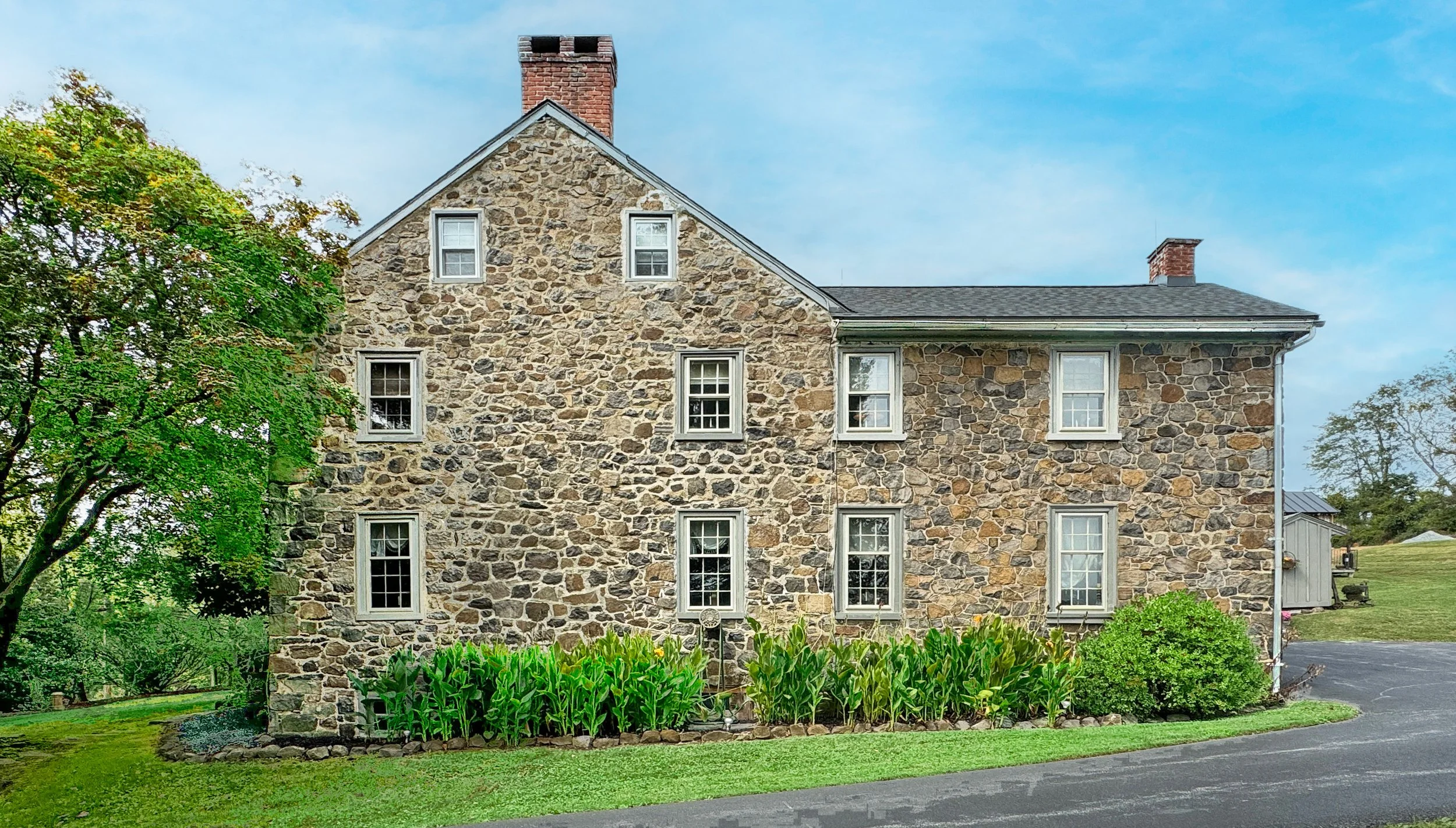
The house’s datestone bears the 1795 date and the letter "H." The floor plan is double-pile (two rooms deep), with a hall-and-parlor arrangement. The west room served as the original kitchen, with a massive walk-in cooking fireplace, an adjacent winder stairway, and a built-in cupboard.
The east side of the core (photo above) was divided into a front and back parlor, each heated by corner fireplaces that tied into a single chimney stack. The rear addition dates to ca. 1850. Image source: Lee J. Stoltzfus.
Ruins of a ca. 1826 Barn:
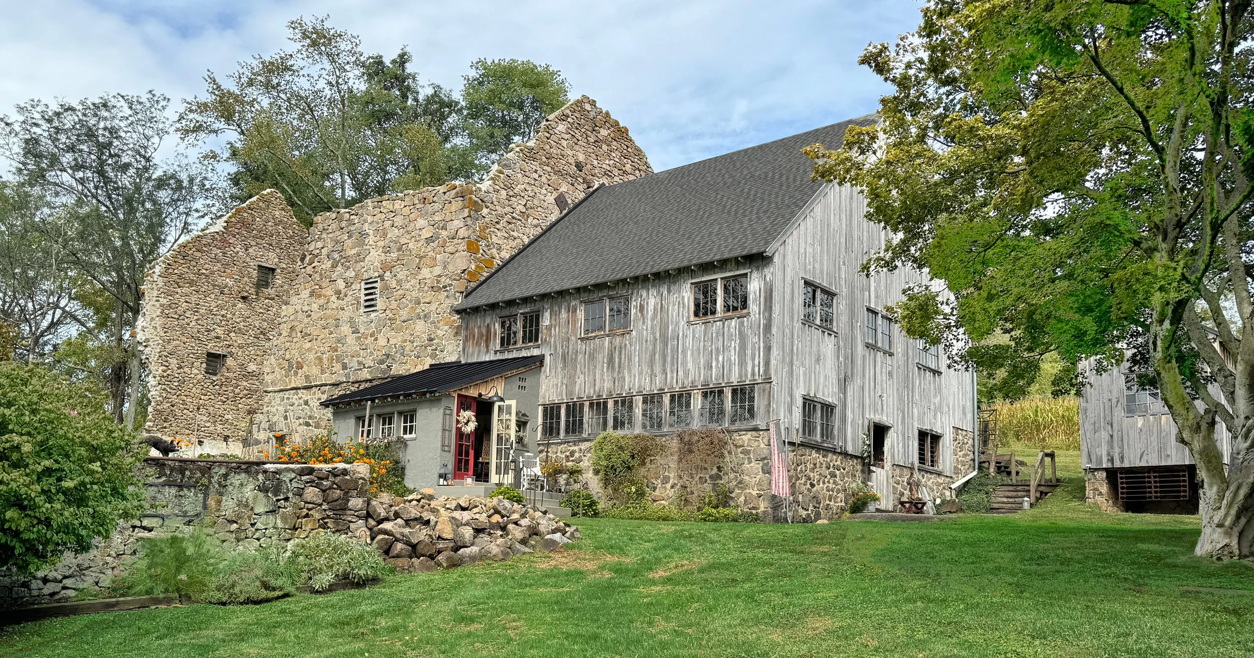
According to an 1826 notice of sale, the property featured a stone house and a "nearly new" stone barn. The structure is a banked, double-decker barn with a stone-walled barnyard. The barn had vertical ventilation slits on the gable walls and a door-above-door layout with louvered ventilators on the south elevation. A frame addition was later appended to the east end. Image source: Lee J. Stoltzfus.
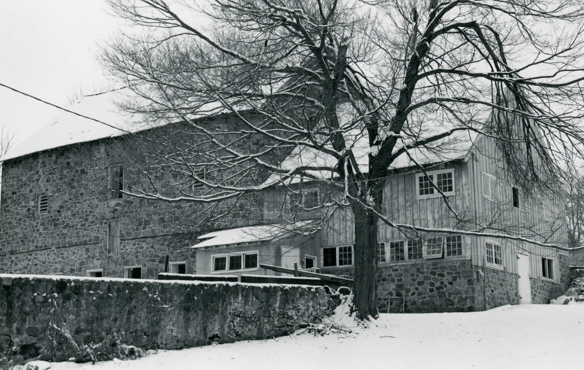
Above: The barn in 1984. Image source: National Register of Historic Places, Emily Hart.
Aerial View of the Hance Farm:
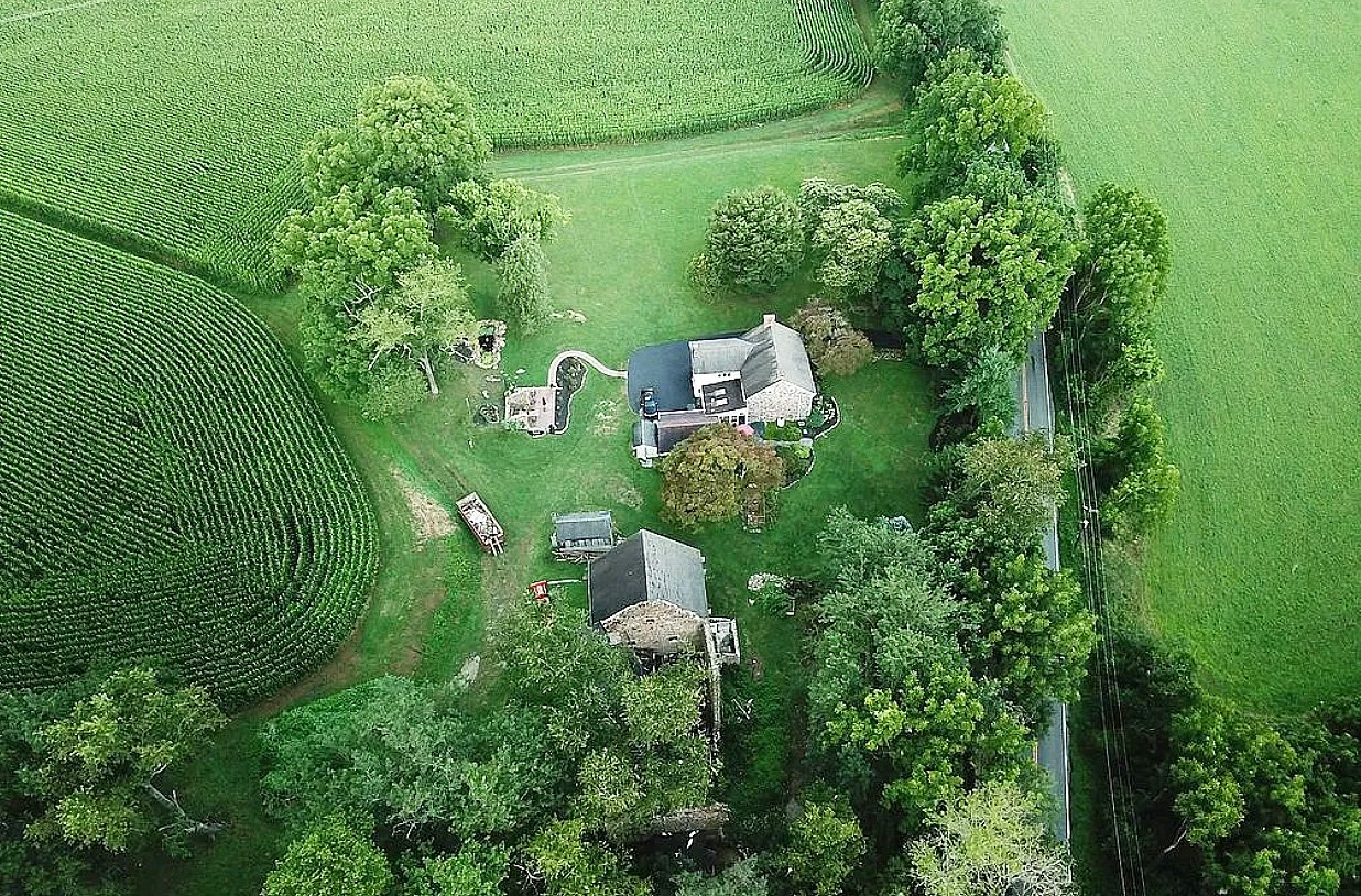
Above: A drone view of the farm reveals the fields surrounding the house. This landmark farm has deep roots with the Buffington, Hance, and Shaw families. Image source: Zillow.
Local Bedrock and Building Stone:
Baltimore Gneiss:
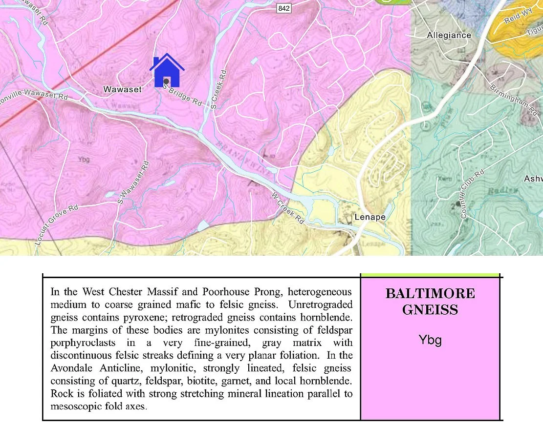
Map image source: National Geologic Map Database, Bedrock Geologic Map of the Unionville Quadrangle…, Wiswall, 2005.
The local building stone at this farm is Baltimore Gneiss, according to this 2005 map. On another map, PaGEODE identifies the bedrock geologic unit here as felsic gneiss.
Links: